Satelytics

0 Reviews
3 Followers
6 Deploys

Setting the standard for geospatial analytics

Page last modified
April 11 2024

Satelytics is a software company. We deliver geospatial analytics, using spectral analysis, our patented algorithms assisted by artificial intelligence, and cloud computing to keep you informed about your assets and provide solutions to your toughest business challenges. The early detection we deliver results in challenges being solved at early stages, therefore minimizing consequences such as:

  • Revenue loss from loss of products or services
  • Remediation and cleanup costs
  • Punitive actions by regulators
Pros & Limitations
1
Assure integrity of all field assets
1
Automated alerts direct your field teams only to problems
1
Early detection minimizes revenue loss from loss of products, remediation costs, and punitive actions by regulators
1
Quantified measurement of chemical and biological constituents
1
Documentation of compliance history
1
Monitor progress of revegetation and afforestation efforts
1
The largest cost factor is in purchasing data from a limited number of capable commercial providers
0
Although we are "data agnostic," our algorithms generally demand a high level of data quality (resolution, spectral bands, view angle). Better data = better results
Specification
Specification Title Specification Description
Inspection
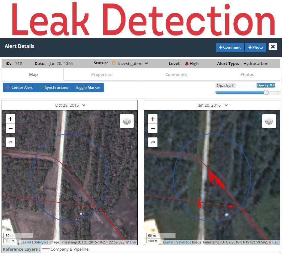
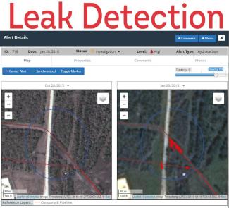
Early identification of pipeline leaks (gas, crude oil, produced water).
Prediction
Identify unwanted right of way encroachments.
Areas of Application
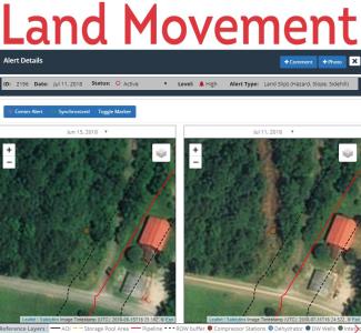
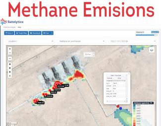
Land movement analysis | Identify illegal hot tapping | Identify acid mine drainage | Chemical species measurement (land/water) | Bathymetry.
Monitoring
Monitor vegetation management programs.
Measurement
Measure revegetation success (tree height / density / speciation) and water quality.

Reviews

Get access to reviews

to your explorer or platform subscription to get access to the reviews written about this technology.

Technology Readiness Level

The Technology Readiness Level (TRL) indicates the maturity level of novel technologies. Learn more about the TRL scale used by us.

[9/9]

Development Technology demonstration Mature / Proven
Ask the supplier
 to contact this technology supplier.

Satelytics is a software company that provides a cloud-based geospatial analytics software suite. Multispectral or hyperspectral imagery is gathered from satellites, UAV, planes, stratospheric balloons, and fixed cameras, and is analyzed to provide both alerts and qualitative results for our customers. Data can be gathered daily and results can be sent to customers in hours. This includes the specific problem, location, magnitude, and even qualitative information, which minimize cost, impact, and operational disruption for our clients.

Relative Business Impact

Solution Deployed By
Company Name

to your explorer or higher plan to get access to all the 6 deployment references.

Last Deployment YearTotal DeploymentsComment