0
Like

SkyX addresses major industry problems with a solution comprising four interoperable cutting-edge platforms:
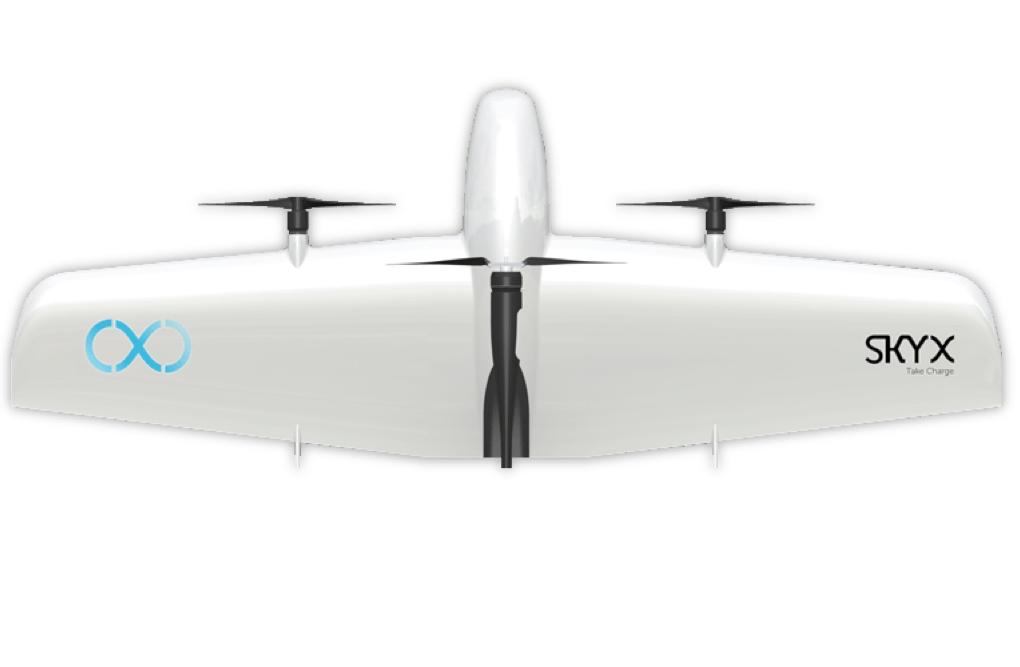
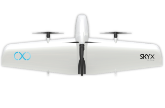
SkyOne & SkyTwo – Remote Piloted Aircraft Systems (RPAS), commonly known as drones, with vertical take-off & landing (VTOL) and long-range flight capabilities. SkyX aerial systems utilise a variety of sensor payloads to conduct the detailed asset inspections that customers require.
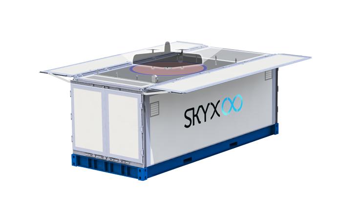
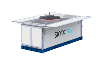
xStation - All-weather ground stations that provide shelter, communications relay, and weather monitoring while the RPAS recharges for its next mission.
SkyXOS – Proprietary software that handles fleet management and links communications between the pilot, aerial system, ground station, and data analytics platform.
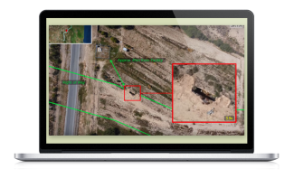
SkyVision – The data warehouse and analytics platform that leverages machine-learning algorithms to analyze raw images, classify anomalies, and produce actionable data insights
| Specification Title | Specification Description |
|---|---|
|
Application
|
Gyrostabilized EO/IR camera system | LiDAR | Multispectral cameras
|
|
Areas of Application
|
Inspection and monitoring of midstream oil & gas assets | Power Transmission lines | Railway Lines | Coastlines and Borders | Infrastructure
|
|
Capabilities
|
Predictive models and big data analytics, anomaly detection and classification, change detection analysis, orthomosaic imagery.
|
|
Operating conditions
|
All weather flight capability.
|
|
Range
|
100 – 250 km | 62 – 155 miles
|
|
Speed
|
100 Kph | 62 Mph
|
 Get access to reviews
Sign up or log in to your explorer or platform subscription to get access to the reviews written about this technology.
The Technology Readiness Level (TRL) indicates the maturity level of novel technologies. Learn more about the TRL scale used by us.
[9/9]


Sign up or log in to your explorer or higher plan to get access to all the 1 deployment references.
Last Deployment Year


